

Regional stock density
The map below shows stock density in the Waikato region. Waikato Regional Council monitor stock density to find out where livestock farming is likely to have the most effect on soil and water quality in the region1.
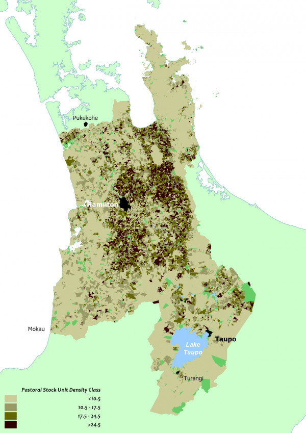
Regional stock density map
Footnotes
- Stock density is calculated by converting farm animals to a common stock unit and dividing by the area of land that the stock graze on. Stock data comes from the AgriQuality AgriBase database.

To ask for help or report a problem, contact us
Tell us how we can improve the information on this page. (optional)