

Regional land use
This map shows the main land uses in the Waikato region. Pastoral farming (52 percent) and exotic forestry (14 percent) dominate the region’s land use.
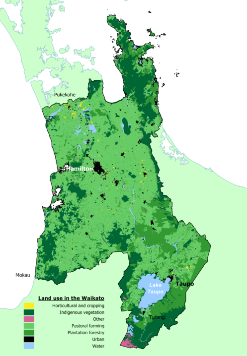
Other land uses include alpine gravel and rock, mixed exotic shrubland, surface mine and transport infrastructure.
Footnotes
- The LCDB 2 dataset is a 'public good' dataset owned by the Ministry for the Environment and supplied by Terralink International Limited.

To ask for help or report a problem, contact us
Tell us how we can improve the information on this page. (optional)