

What is Project Yellow?
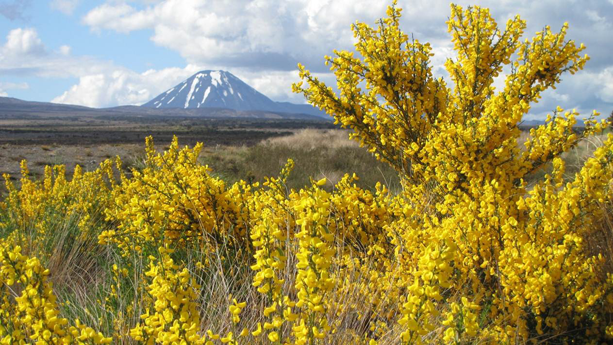
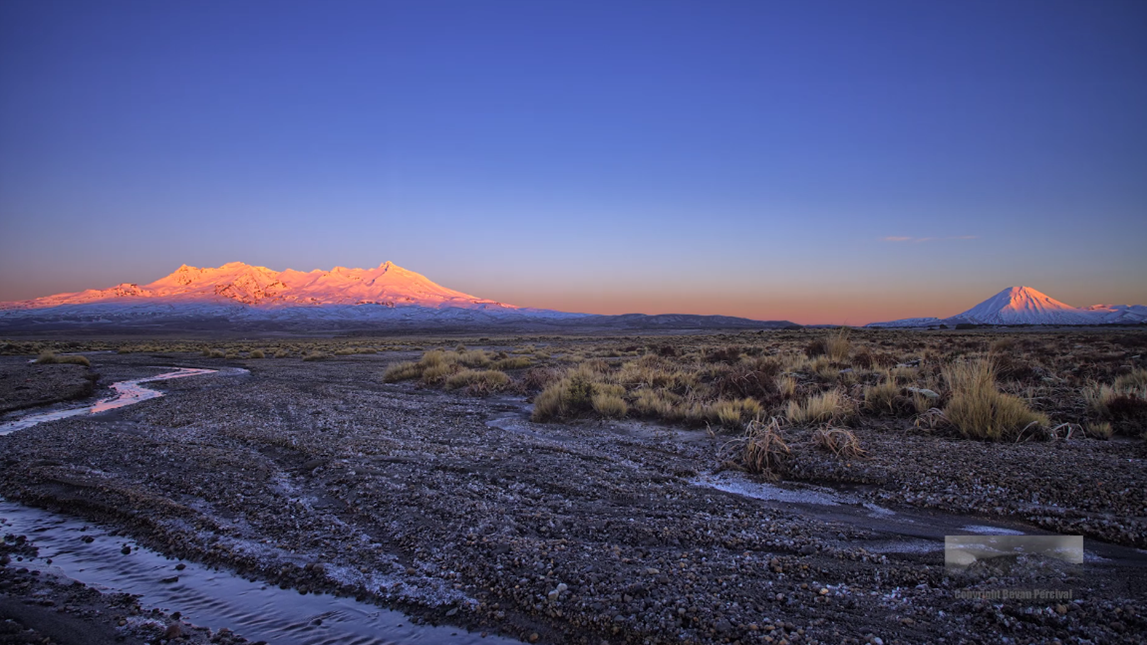
The Desert Road stretch of State Highway 1 running through the Central Plateau provides expansive vistas of three spectacular mountains as well as of unique mix of tussock and forest, making the drive a truly memorable experience.
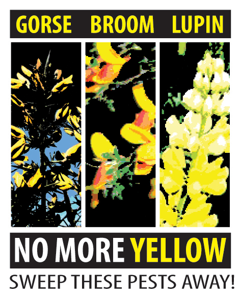 Sadly, the view and, even worse, the integrity of the fragile ecosystem that attracts trampers, hunters and photographers is being threatened by the increase in abundance and spread of invasive exotic plants. The yellow peril of gorse, lupin and broom are on the way to reaching a critical mass that will permanently modify this landscape.
These plants change the fertility of the naturally nutrient poor soils, encouraging other introduced plants and grasses and thereby compounding the problem. Broom produces chemicals that prevent native seedlings establishing and then forms dense thickets able to shade out all other regenerating plants. This can occur from the road edge right to the snow line. Imagine a white mountain sticking out through a sea of yellow weeds?
To arrest this spread and protect this magnificent place, a collective of the organisations that manage land in a 23,000-hectare chunk of the plateau are working together.
Known as the Desert Rd Invasive Legume Control Group, their mission statement is:
“The unique natural values and vistas of the Desert Road environments are preserved.”
To achieve this mission, the Desert Rd Invasive Legume Control Group has created a Memorandum of Understanding to guide planning and operations over the next 10 years. The group’s core intent is:
- co-operation to achieve – between all stakeholders
- introduced legumes are eradicated
- monitoring – to ensure success
- advocacy – to engage more stakeholders
- pathway management – to protect the asset of what’s been controlled.
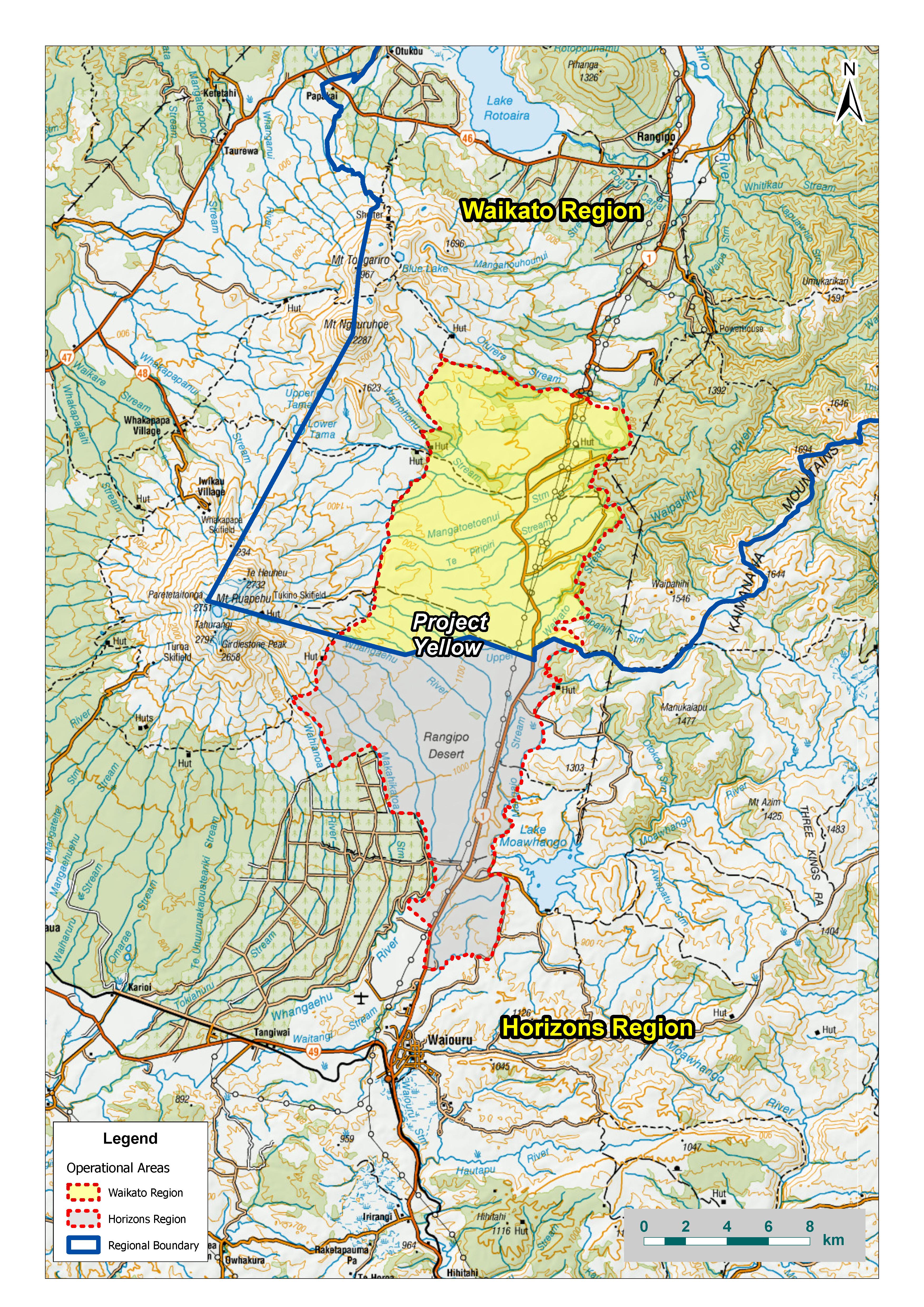
Project Yellow boundary map
Proposed schedule of works 2020-2023
| Year | Works | Comments |
| 2020 | Aerial photography and distribution mapping and description for gorse. Mid- Late October. |
Discussion around flying overlaps of previous distribution only was investigated 2019. Saving of $3000. Costs shared if possible. |
| 2021 | Aerial photography and distribution mapping and description for lupin. Early Jan | Species is not so widely distributed therefore a targeted re-mapping would be recommended. |
| 2022 | Aerial photography and distribution mapping and description for broom. November flight. | Full area. |
| 2023 | Final mapping produced. | Each species will have a baseline and assessment map, with broom having the 2016 progress map as well. |
| Signage/Interpretation installed finished | Likely spots are Tukino skifield access road, gravel area South of Aquaduct rest area. | |
| Future MOU or other commitment. | ||
| Conference presentation of results | Example of celebrating the project. |
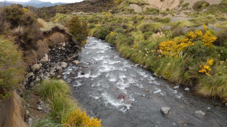 Broom growing by a Desert Road stream.
Meeting information

Papers on Rangipo Desert ecology and the significant impact of legume invasion
Technical papers and reports are available for you to read, below.
-
Predicting native plant succession through woody weeds in New Zealand
2.3 MB

-
Acacia saligna’s soil legacy effects persist up to 10 years after clearing: Implications for ecological restoration
399 KB
-
Barriers to ecosystem restoration presented by soil legacy effects of invasive alien N2-fixing woody species: implications for ecological restoration
364 KB
-
North Island seral tussock grasslands 1. Origins and land-use history
1.9 MB
 Let's make sure the unique natural values and vistas of the Desert Road environments are preserved.
Partner organisations

To ask for help or report a problem, contact us
Tell us how we can improve the information on this page. (optional)