

Waikato Regional Hazards Portal
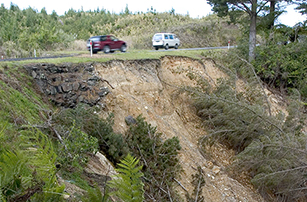
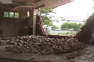
Natural hazards have the potential to cause disruption, damage properties and take lives.
They can also affect the value and insurability of properties. This is important to consider when purchasing a property, particularly with climate change projected to increase the frequency and severity of events such as river flooding and coastal erosion and inundation.
The Waikato Regional Hazards Portal has been developed to improve access to regional natural hazard information, and to help the public, local authorities and others manage risk and make informed decisions about their exposure to natural hazards.
The Portal contains all available (suitably robust) spatial hazard information that is held by Waikato Regional Council, as well as data from other organisations.
New and updated information will be added as required. It is intended to partially replace the online request for flood hazard information, although this service will still be available to answer specific questions and to provide flood levels (referencing the Cross section ID provided in the Portal).
Terms of use
Please note that by using the Waikato Regional Hazards Portal you are deemed to have agreed to the Terms of Use.
Also note that the Portal is not intended as a substitute for a Land Information Memoranda (LIM), which can be obtained from your local district/city council.
Information level classifications
The information contained in the Portal is of different levels of accuracy, reflected in the visible display scale of the data. For some data, you will need to zoom in or out in order to make it visible – see the Layer Descriptions in the sidebar for a list of the data in each tab.
Also included in the Layer Descriptions section is an “Information Level” classification. This classification is to inform users of the applicability and accuracy of each of the data sets. For example, local scale flood depth data can be used to inform minimum floor levels for building consents, but the regional scale flood hazard data is only suitable as a ‘heads up’.
The following table describes each of the Information Levels:
Information level |
Description |
1 |
Property to local scale Information that is suitable to be used for resource/building consents or for District Plans. This information is generally based on detailed modelling or hazard mapping that takes the effects of climate change into account (if applicable) and/or is based on all possible scenarios and their associated likelihoods and impacts (probabilistic assessment). |
2 |
Local to regional scale Information that is suitable to be used for District or Regional Plans. This information is generally based on modelling or hazard mapping, but may not take the effects of climate change into account and/or may be based on only one scenario (deterministic assessment). |
3 |
Regional scale Information that is suitable to be used for the Regional Policy Statement or regional scale studies/projects. This information is generally based on previous event or historic mapping/aerial imagery. |
4 |
General information Information that is to be used for information purposes only. This information is generally based on national scale mapping, preliminary regional scale mapping, or susceptibility from other existing data (eg. LiDAR data). |

To ask for help or report a problem, contact us
Tell us how we can improve the information on this page. (optional)