

Classifying geothermal systems by natural values
We can classify our geothermal systems by their natural values. Classifying our geothermal systems helps us determine the most suitable management approach for each system.
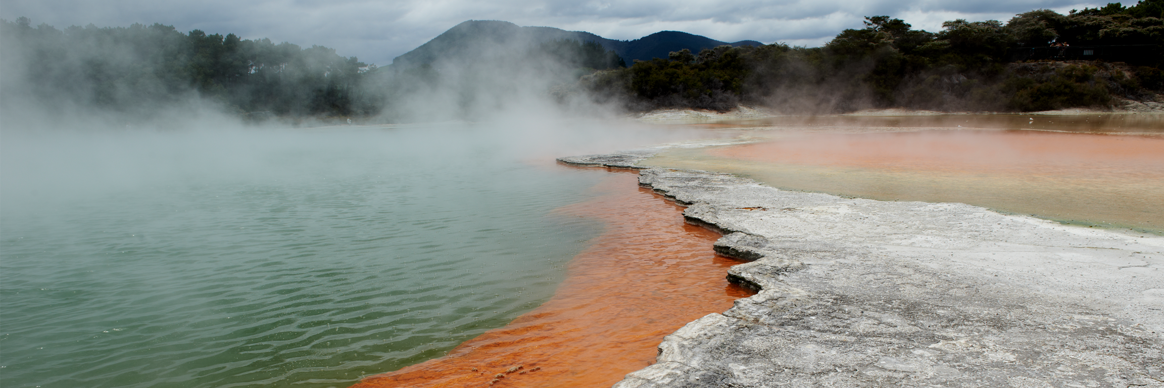
Surface features of a geothermal system may be:
- an isolated feature (a hot spring or mud pool, or geyser or area of steaming ground)
- a set of features grouped together
- several sets of features fed by a single upflow (a geothermal field).
When activities on one geothermal field (such as water extraction) affect another field, the fields are regarded as parts of the same geothermal system. For example, the Wairakei-Tauhara system is made up of the Tauhara and Wairakei fields.
The system itself includes:
- a body of geothermal water
- material containing heat or energy surrounding the water
- all plants, animals and features dependent on it.
Check out our map of geothermal systems in the Taupo Volcanic Zone, below.
Classification and management
Increased pressure to develop and use geothermal resources prompted Environment Waikato to classify the Region’s geothermal systems into five categories:
- Development
- Limited Development
- Research
- Protected
- Small.
Classification is based on ranking each system’s characteristics and aims to balance development with the protection of highly valued surface features. There is a different management approach for each category.
In areas classified for Development, large-scale uses are allowed as long as they are undertaken in a sustainable and environmentally responsible manner.
In Limited Development systems, takes that will not damage surface features are allowed.
Research systems are those where not enough about the system is known to classify it as either Development, Limited Development, or Protected. In these systems, only small takes and those undertaken for scientific research into the system are allowed.
Protected systems contain vulnerable geothermal features valued for their cultural and scientific characteristics. Their protected status ensures that their underground geothermal water source cannot be extracted and that the surface features are not damaged by unsuitable land uses.
Small systems are isolated springs or sets of springs. These can only sustain small takes and are not suitable for electricity generation.
Classification of our major geothermal systems
-
System Reason Horohoro Few surface outflows vigorously depositing sinter. No evidence of a flow of subsurface geothermal fluid to or from a Protected Geothermal System. Mangakino Few surface outflows vigorously depositing sinter. No evidence of a flow of subsurface geothermal fluid to or from a Protected Geothermal System. Mokai No surface outflows vigorously depositing sinter. No evidence of a flow of subsurface geothermal fluid to or from a Protected Geothermal System. Ngatamariki No surface outflows vigorously depositing sinter. No evidence of a flow of subsurface geothermal fluid to or from a Protected Geothermal System. Ohaaki Existing surface features significantly impaired by legally established large takes. No evidence of a flow of subsurface geothermal fluid to or from a Protected Geothermal System. Rotokawa Few surface outflows vigorously depositing sinter. No evidence of a flow of subsurface geothermal fluid to or from a Protected Geothermal System. Wairakei - Tauhara Existing surface features significantly impaired by legally established large takes. No evidence of a flow of subsurface geothermal fluid to or from a Protected Geothermal System.
Development geothermal systems
Limited development geothermal systems
Research geothermal systems
Protected geothermal systems
Taupo Volcanic Zone Geothermal Systems
Most of the Waikato region’s geothermal resource is actually underground. The geothermal activity we can see on the Earth’s surface is much more restricted in size and distribution. One way of determining the extent of geothermal systems is by measuring the ground’s electrical resistivity.
This map shows the geothermal systems in the Taupo Volcanic Zone as they are defined by electrical resistivity. Find out more about resistivity.
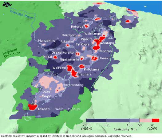
Resistivity is a measure of the ground’s ability to conduct electricity. Generally, geothermal water has lower resistance (conducts electricity better) than normal ground water.
- Low resistivity (red) indicates the presence of geothermal water.
- High resistivity (purple) indicates normal ground water, soil and rock.

To ask for help or report a problem, contact us
Tell us how we can improve the information on this page. (optional)