

The Kahikatea Green Wheel can help you if you are:
- currently restoring or planning to restore a kahikatea forest patch on your land.
- managing a reserve or covenant with kahikatea forest.
- needing to show funders you are making a difference.
- wanting to check on the health of your kahikatea forest patch, or track how your restoration project is going.
If you are putting time and money into protecting and enhancing your kahikatea forest patch, it’s worth checking on how it’s doing to make sure your efforts are paying off.
Why kahikatea forest?
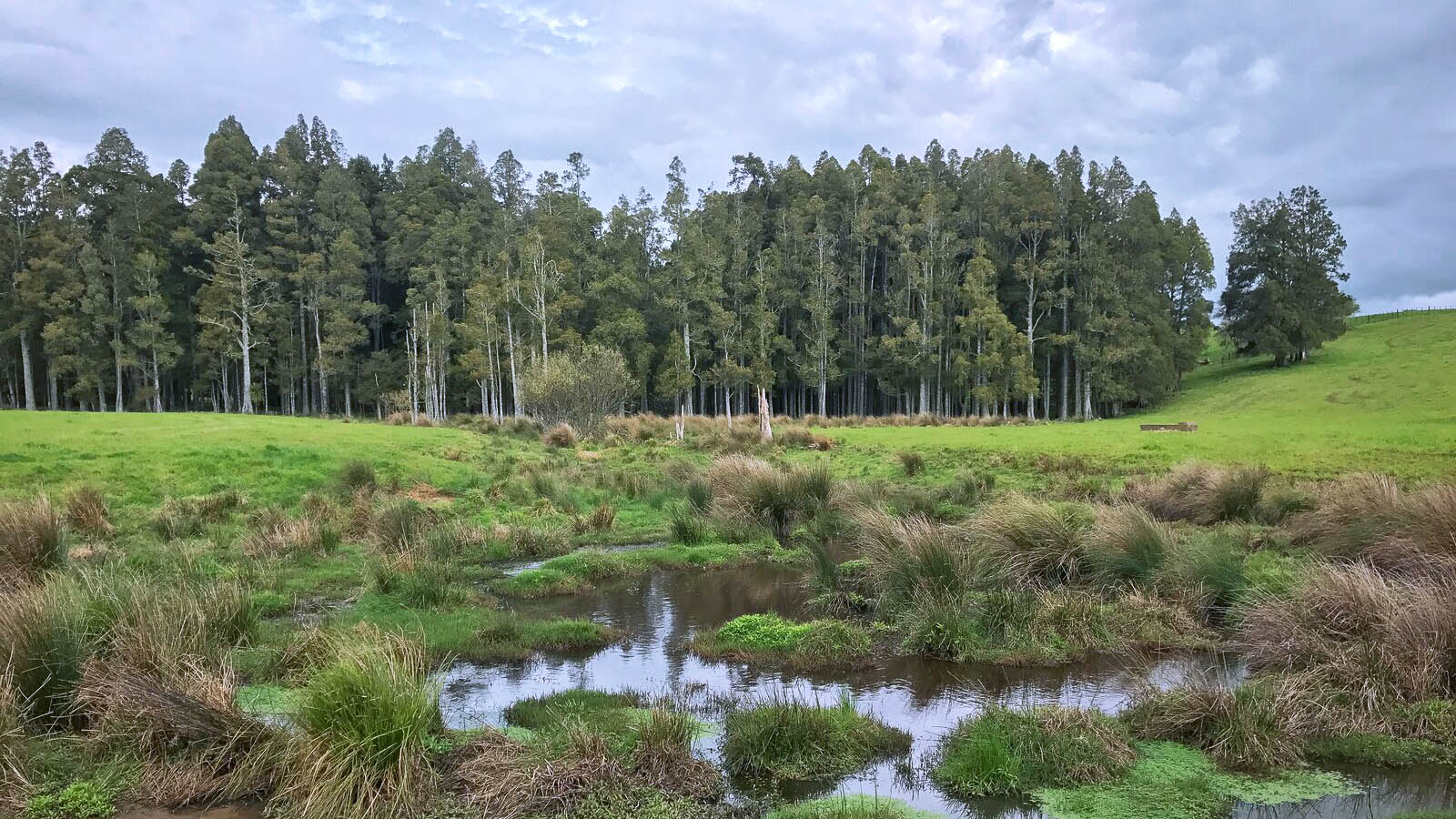
Kahikatea (Dacrycarpus dacrydioides) is an ancient podocarp and New Zealand’s tallest native tree. Before humans arrived in the Waikato, around 200,978 hectares of kahikatea forest grew in the wet areas beside lakes and swamps, and on floodplains.
Today there are only around 3965 hectares – a 98 per cent decrease. Many are secondary forests, grown anew on land previously cleared by early settlers. They are tiny, mostly under 5 hectares, and vulnerable to pests, stock damage and other threats.
Yet they remain a classic landscape feature of the Waikato lowlands – often the only native vegetation around – and provide core habitat and stepping stones for native birds.
Waikato Regional Council has taken steps to encourage protection and restoration of these iconic indigenous forest stands.
The council:
- supports kahikatea research and monitoring
- encourages landowners to protect and enhance kahikatea forest patches
- provides funding incentives and how-to factsheets for people who want to restore or replant kahikatea forest
- created the Kahikatea Green Wheel for landowners to check on the health and recovery progress of their kahikatea forest.
Here’s how it works
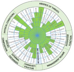
- Use the KGW guide to score 31 important features (sub-attributes) from 1-5.
- Plug your results into a spreadsheet.
- Instantly create a wheel chart which shows how well your site is doing.
The greener your wheel spokes, the healthier and better managed your site is.
To score your kahikatea site you will need to visit it to collect data. You may need a botanist to collect some of the information, but this will only need to be done every five years. Some of the information you will need is on our kahikatea forest map.
Use the tools and documents below to complete your Kahikatea Green Wheel.
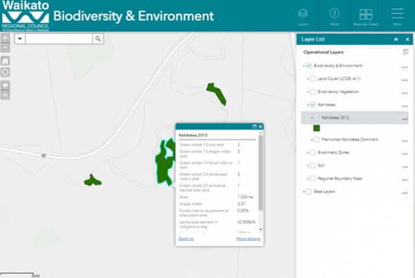
Get KGW scores from our kahikatea forest map
You can get scores for five of the KGW sub-attributes from our website.
Find your kahikatea patch on the Biodiversity and Environment map, and write on your Site Datasheet the Kahikatea Green Wheel scores for sub-attribute numbers 12, 13, 14, 24 and 25.
To find your kahikatea patch:
- Open the Biodiversity and Environment Map (refer to the below screen shot of the map).
- Ensure the ‘Layers List’ box is visible on the right. If not click the ‘layers’ button on the top toolbar.
- Tick Biodiversity and Environment and click the little triangle beside it to open more layers.
- Tick Kahikatea and the triangle beside it.
- Tick Kahikatea 2012 (or the most recent version).
- Turn off all other layers, including Pre-human Kahikatea and Biodiversity Vegetation, so only kahikatea forest is visible on the map.
- Type your address into the search box to find patches on your land. You can turn on a satellite photo or topographic map from the Base Map Gallery, to make it easier to find your stand.
- Click on the stand you want to gather information on, and enter the Green Wheel rank values for the following sub-attributes into your Site Datasheet.
12) Size
13) Shape
14) Forest interior
24) Landscape matrix (nearby habitat)
25) Habitat links (terrestrial)
Kahikatea Green Wheel documents and tools
Landowner guide
First read the Guide to the Kahikatea Greenwheel. When you are ready to start, download a copy of the Site Datasheet and the Photopoint Datasheet.

My Kahikatea Green Wheel
Download the spreadsheet and enter data from plant and animal surveys, and from our Kahikatea forest map to generate your Kahikatea Green Wheel.

Completed KGW example
See a real-life example for Turney Bush. Visit Turney Bush at Lake Rotopiko/Serpentine, south of Ōhaupō, State Highway 3, and see how the KGW values were applied.
Animal monitoring
Download instructions on how to set up tracking tunnels to monitor native and pest animals.
Characteristic native plants and bird food plants
Get a list of plant species that are characteristic of healthy Waikato kahikatea fragments, and those that provide bird food. Use this list to help you restore your site.
For the botanists
Download the Botanists Quick Guide with simple instructions and a set of handy field datasheets, or read the full Technical guide for background information.
Download the KGW Spreadsheet. Tick the species in your site in the Native Plants and Unwanted Plants tabs. The spreadsheet will generate KGW scores from your list.

To ask for help or report a problem, contact us
Tell us how we can improve the information on this page. (optional)