

Extent of coastal habitats
Why we monitor the extent of coastal habitats
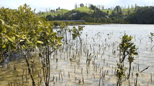
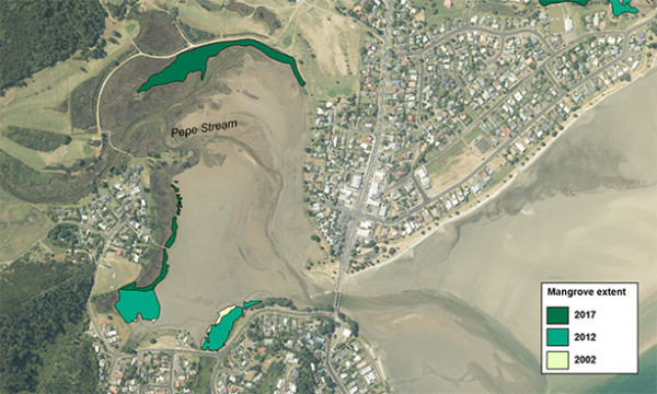
Mangroves in Whangamata
Our coastal habitats and ecosystems are diverse and highly valued for recreational, commercial, and cultural reasons. This indicator describes the extent of mangrove habitat in selected estuaries. The extent of mangrove habitat is an indicator of ecosystem health.
Mangroves (Avicennia marina) are a native species that grow in estuaries in the northern part of New Zealand, and they provide habitat for a variety of plants and animals. Mangroves also help to shield coastlines from storm damage and wave action, can improve water quality by trapping sediment and contaminants, and provide a carbon sink in the same way that terrestrial forests lock up carbon. However, rapid mangrove expansion in estuaries can be a symptom of increased sedimentation. Sedimentation rates in Waikato region estuaries have increased markedly following the clearance of forest, and urban and rural development.
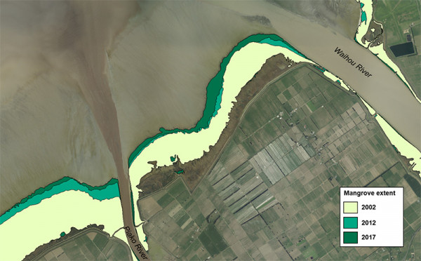
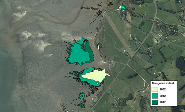
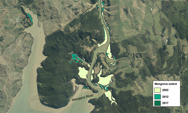
The information for this indicator is based on interpretation of aerial photographs taken in 2002, 2012 and 2017 from Waikato Regional Aerial Photographs (WRAPS). Field surveys of estuarine vegetation and oblique aerial imagery have helped in the interpretation of the aerial photographs.
What's happening?
In 2017, the Firth of Thames mangrove forest covered 1476 ha in area, and there was 83 ha of mangroves in Coromandel Harbour, 36 ha in Whāingaroa (Raglan) Harbour and 30 ha in Tairua Harbour. Between 2002 and 2017, the total extent of mangrove habitat increased in three out of the four monitored estuaries. In Coromandel Harbour and Whāingaroa Harbour, mangrove extent increased by nearly 40%. Mangrove extent also increased by 12% in the Firth of Thames. In Tairua Harbour, mangrove extent increased between 2002 and 2012, but the consented clearance of c. 9 ha of mangroves between 2012 and 2017 resulted in an overall decrease in mangrove habitat of 11% between 2002 and 2017. The expansion of mangrove habitat in these estuaries is likely the result of increased sedimentation.
How we monitor
Results - data and trends
Download the data file
The Excel spreadsheet below contains the source data to this indicator's graphs and any additional data.

When this indicator is updated
This indicator is updated every five years, with the next update scheduled for 2026.
Updated 19 May 2021

To ask for help or report a problem, contact us
Tell us how we can improve the information on this page. (optional)