

Why we monitor pastoral intensification
Conversion of plantation forest land to pastoral land uses, dairy conversions, changes in stocking rates, and farming intensity change the pressures on soil and water quality in the Waikato region.
Waikato Regional Council monitors pastoral intensification to indicate where there are current and possible future pressures on the environment from livestock farming and the conversion of land from pine forest to pastoral use.
Intensive pastoral land use, especially where the intensity is more than the land and soil can support over the long term, can lead to loss of soil, increased impacts on stream banks, and effects on local water quality.
For example:
- Increased nitrogen leaching to groundwater, more runoff of sediment, nutrients, and bacteria into waterways,
- Damage to soil quality from pugging and compaction,
- Erosion or damage to riparian (streamside) areas and wetlands,
- Damage to habitats for stream life.
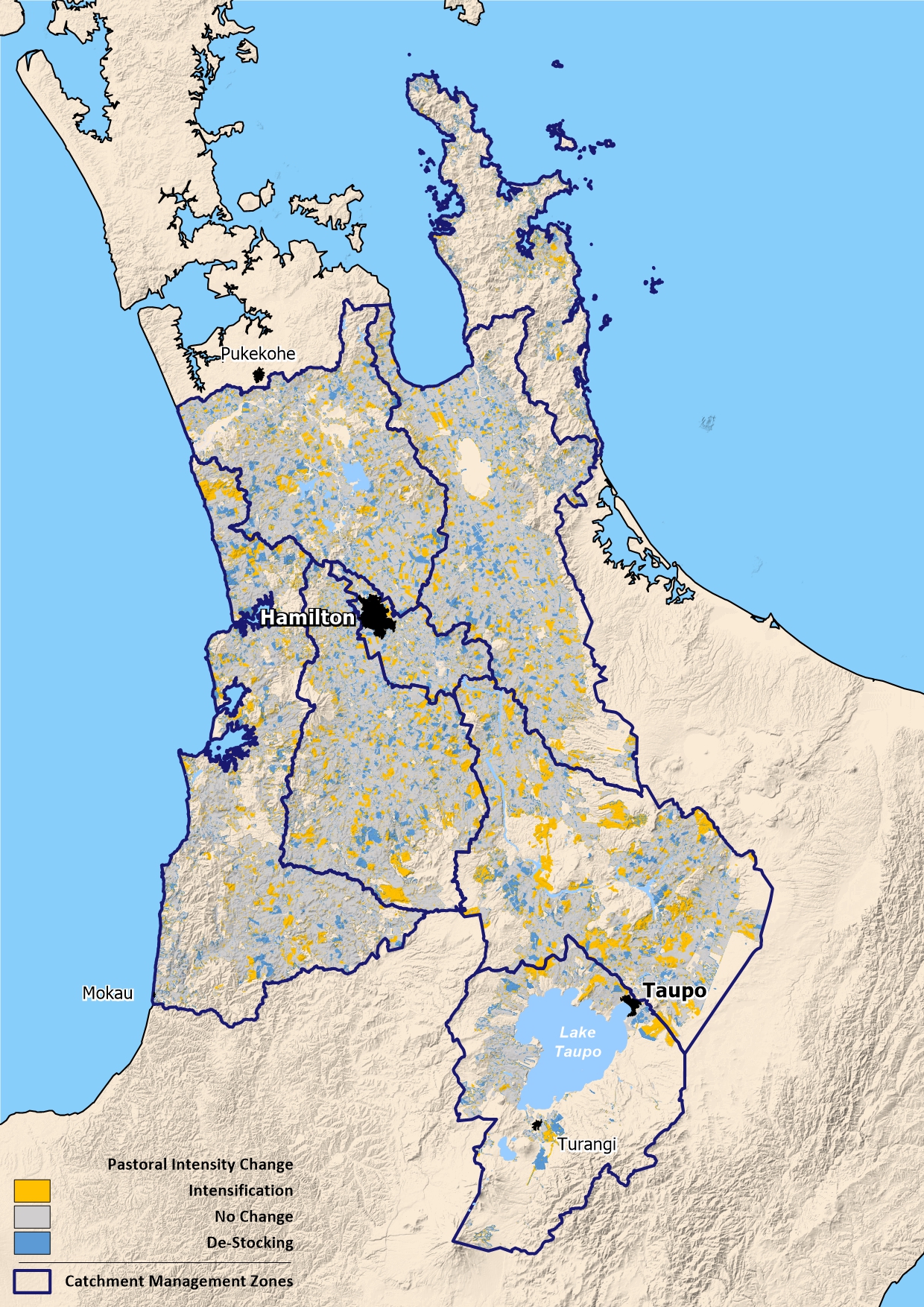
Waikato Regional Council calculates changes in pastoral intensification in the eight major catchment management zones in the Waikato region.
This helps us determine where pastoral land use is increasing, intensifying, or becoming less intensive. Waikato Regional Council will monitor changes in pastoral intensification over time to indicate where pressure from stock on the environment is increasing or decreasing.
Pastoral intensity in the Waikato region may increase over time if:
- Pine forest conversion to pasture continues,
- Dairy conversion continues,
- Technological advances lead to more intensive farming systems.
Pastoral intensity in the Waikato region may decrease over time if:
- Pasture is converted to pine forest or retired,
- Dairy stock numbers are reduced,
- Technological advances lead to less intensive farming systems.
What's happening?
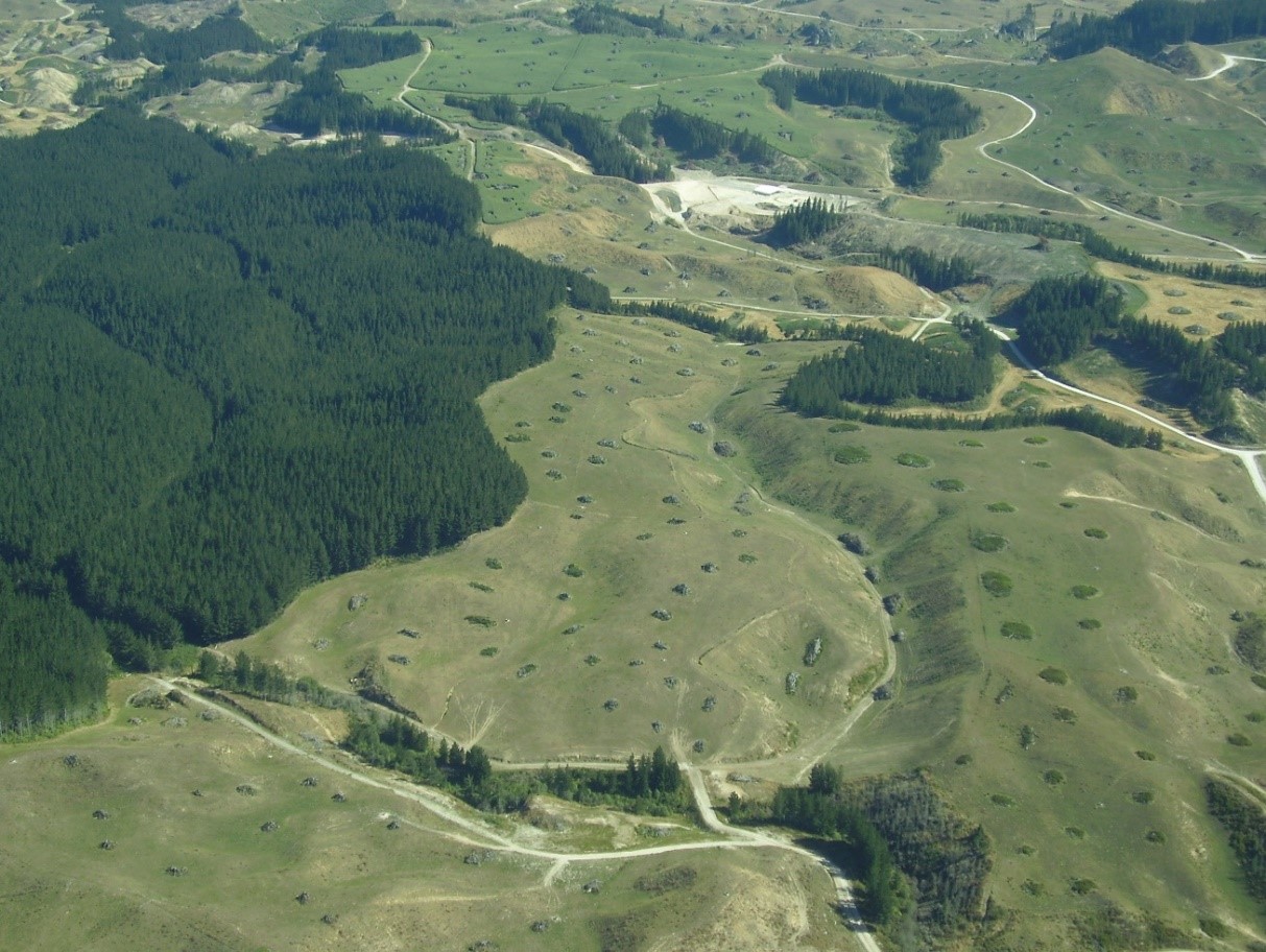
Waikato Regional Council monitors pastoral intensification to find out where livestock farming is likely to have the most effect on soil and water quality in the region. The indicator includes land that has been converted from pine forest to pastoral land use.
We recognise that the level of effects on the environment will also depend on local soil type, farm management systems, and proximity to sensitive ecosystems. The pastoral intensification indicator helps us to target education and policy responses to protect soil and water quality in the areas where livestock farming is most intensive.
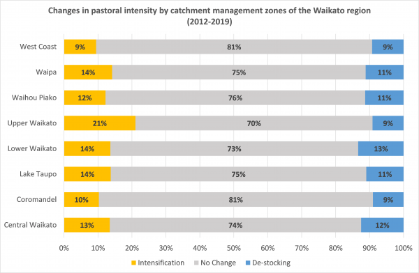
The pastoral intensification indicator shows that:
Across the region
- Most of the pastural land in all catchment management zone showed no change.
- Net pastoral intensification occurred in all catchment management zones across the region, except in the West Coast zone (+0%).
- The greatest net pastoral intensification occurred in the Upper Waikato catchment management zone (+12%).
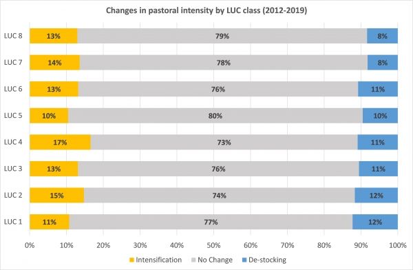
Across different types of land use capability (LUC classes)
- Most of the pastural land in all LUC classes showed no change.
- The greatest net pastoral intensification occurred on LUC class 4 pasture (+6%). This LUC class is land that can support a range of pastoral land uses including dairy and drystock farming.
- The greatest net de-stocking occurred on LUC class 1 pasture (+1%). This LUC class is land that can support intensive pastoral land uses.
How we monitor
Data and trends
The data in these graphs is based on:
- stock density data collected by AsureQuality Limited, as at January 2020,
- Land cover data (LCDB version 5.0), and
- Land Use Capability class map data from the New Zealand Land Resource Inventory
View our map of pastoral intensification in the Waikato region.
View the data file
The link below points to a file that contains the source data to this indicator's graph and any additional data. The file is intended to be opened in spreadsheet software.

When this indicator is updated
This indicator is updated every five years.

To ask for help or report a problem, contact us
Tell us how we can improve the information on this page. (optional)