Where, why and when it’s happening
Where it's happening
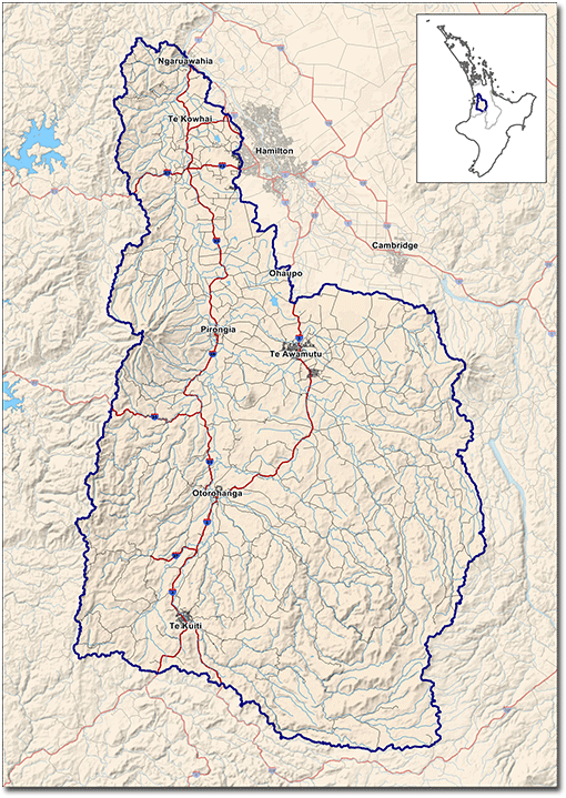
The Waipa Catchment Plan covers the entire Waipa River catchment but also identifies priority areas within the catchment.
In priority areas, on-farm actions to reduce erosion, maintain water quality and protect biodiversity would make the greatest difference to the Waipa River’s water quality. Some of these areas currently have the greatest impact on the river’s water quality.
In the priority areas, Waikato Regional Council intends to partner with other agencies to support farm landowners in maintaining water quality and protecting biodiversity. For more information, see Supporting priority areas.
Waipa River catchment

Why it's happening
Key drivers for the Waipa Catchment Plan are:
Declining water quality
The Waipa River’s water quality generally declines as it travels from its source. Sediment levels are high in its lower reaches, and have risen over the last 20 years. In many water bodies in the catchment, nitrogen levels have risen and bacteria levels are high but appear to be stable. Find out more about the Waipa River and what contaminates the Waipa River.
Vulnerability to erosion
The catchment’s erosion prone soils and unstable stream and riverbanks put sediment into the Waipa River, and eventually the Waikato River. Increased erosion from pasture development on steeper land is anticipated, and climate change could cause more heavy rainfall events.
Land use change and intensification
Urbanisation and the expansion and intensification of agriculture put the catchment’s productive soils at risk and could worsen erosion and water quality.
Loss of indigenous biodiversity
Ongoing, serious loss of indigenous biodiversity is occurring. The long term health of significant ecosystems requires an ‘ecological network’ approach which connects habitats. This approach requires co-operation and collaboration with multiple stakeholders and high quality information.
Flood risks
Areas of the catchment (including Te Kūiti and Ōtorohanga) are located in floodplains and were severely flooded in 1958. Flooding in the catchment could endanger people and property and damage existing flood protection infrastructure, such as that protecting Te Kūiti and Ōtorohanga. Afforestation and restoration or retention of natural wetlands could reduce flood risks in the upper catchment.
Iwi aspirations for the river
Waipa and Waikato river iwi – Waikato-Tainui, Ngāti Maniapoto, Raukawa and associated hapu – have aspirations for the Waipa River which include restoration and protection.
Enhancing current work programmes and approaches
The Waipa Catchment Plan signals a more strategic approach that will integrate a range of issues such as indigenous biodiversity habitat restoration and protection, flood management and other community goals into work programmes. An independent review Waikato Regional Council sought of its sustainable land management programmes highlighted areas for improvement around prioritisation of catchments and the type of work done. A broader base of scientific information on the catchment and modelling will enable better prioritisation. Funding strategies will also be revised to support landowners in priority areas to make changes on farm.
When it's happening
| Expected upcoming dates for support in priority areas | |
| Nov 2014 - July 2015 |
|
| From July 2015 |
|


To ask for help or report a problem, contact us
Tell us how we can improve the information on this page. (optional)