

 Funded: $2.29m by MBIE (climate resilience)
Total project cost: $8m
Project duration: 3 years
Jobs expected over project life: 21
The Piako River flood scheme includes a range of flood protection assets to protect people and property from frequent flooding. These assets include drains, stopbanks, floodgates and pump stations that provide varying levels of protection depending on location and land use.
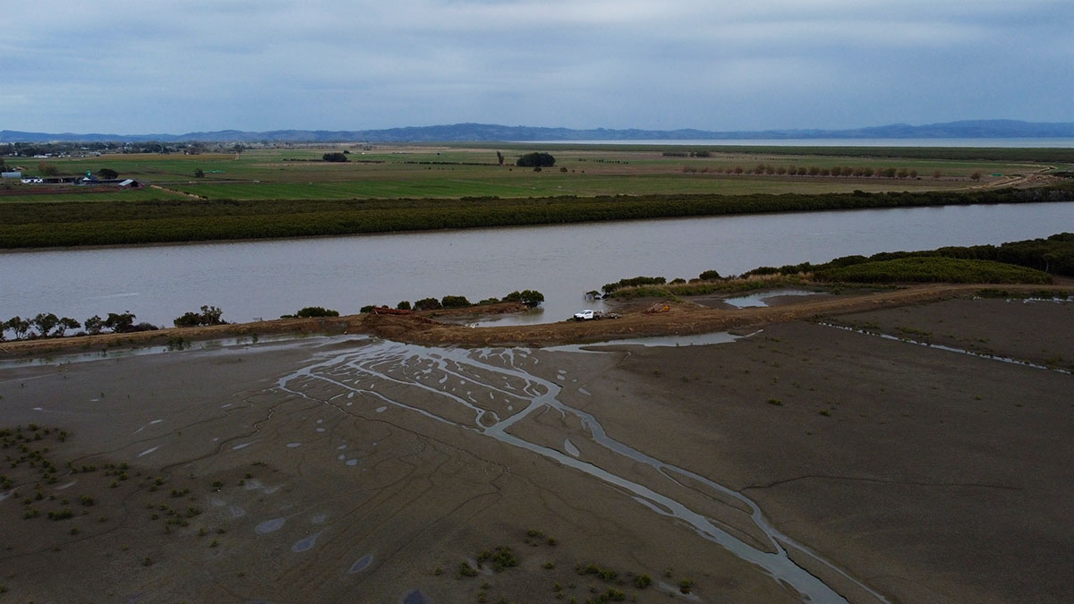
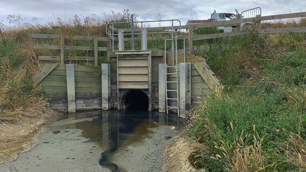
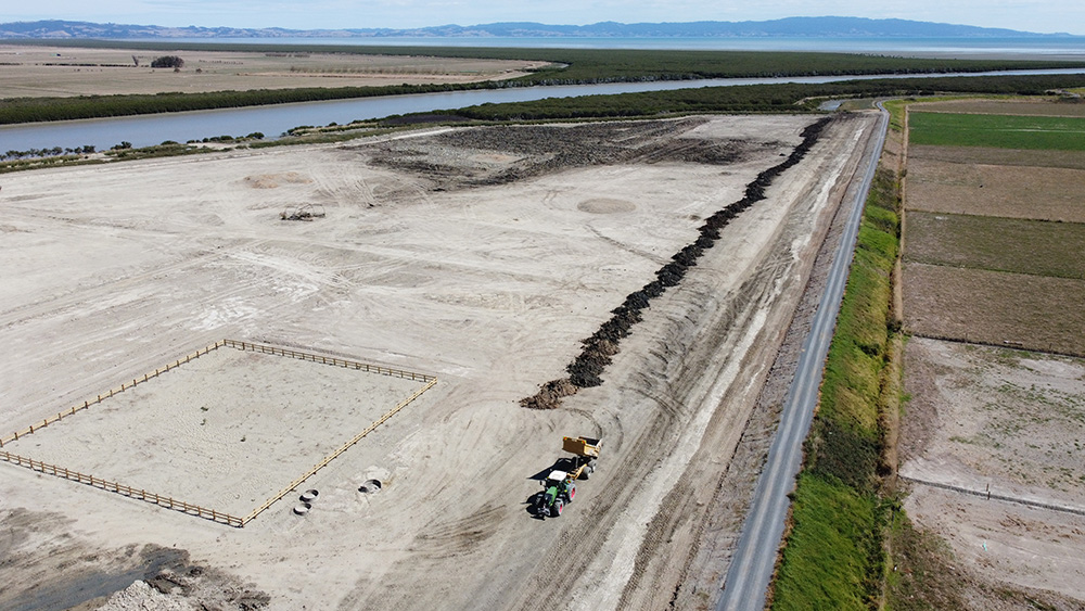
Three floodgates on the true right bank near the mouth of the Piako River and the Firth of Thames are nearing the end of their useful life. The floodgates provide protection to 850ha of good agricultural land and the communities within. This project seeks to rationalise these into one floodgate asset to reduce replacement and ongoing operation and maintenance cost as well as ensuring the level of service is maintained along with options for longevity of flood protection in this area.
This area has significance due to the RAMSAR site at the Firth of Thames, and the link to the RAMSAR site at the Kopuatai Peat Dome. Wetland habitat will be created where stopbanks are set back. This project ties in with the Piako River green corridor project.
Benefits:
- Continue the productive value of the Hauraki Plains, community resilience and employment opportunities.
- Peace of mind for both rural and urban communities while protecting existing and future investment in the Hauraki Plains.
- Rationalisation/streamlining of assets will save ratepayers a significant amount of money in future maintenance and asset costs.
- Wetland habitat to augment the ecological corridor to be created along the Piako River from Kopuatai Wetland to the Firth of Thames.
- Protection of established wading bird habitat.
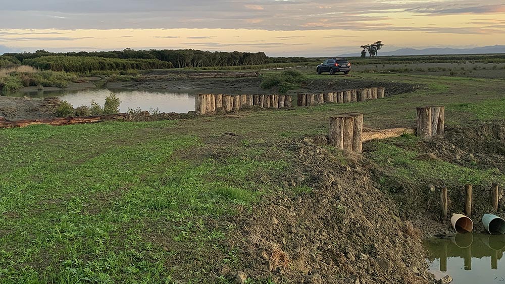
- Creation of inlet drain as a refuge pond for fish during drought conditions.
Progress update:
- Independent peer review of hydraulic model has confirmed asset rationalisation is feasible and the location of the new asset has been confirmed.
- Detailed hydraulic modelling to finalise construction design parameters is complete.
- Stakeholder consultation on the concept design complete, receiving wide support.
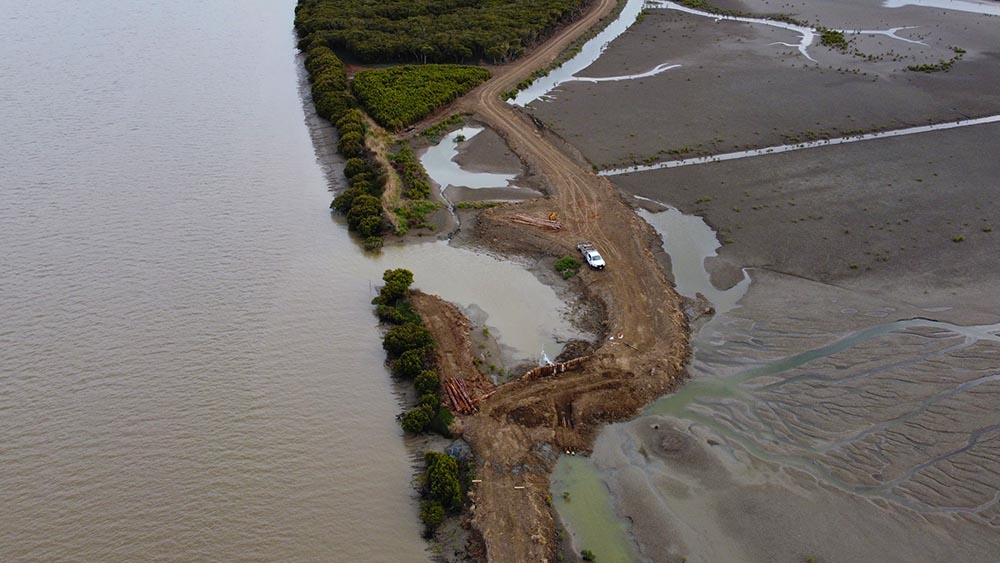
- Earthworks to repair the old stopbank breach is complete.
- Earthworks and land use consents granted.
- Stage 1 earthworks contract for formation of surrounding stopbanks is complete.
- Structures consent application nearing completion.
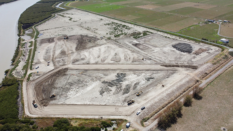
- Stage 2 earthworks contract was significantly disrupted by poor weather over 2022/2023 summer but all drainage upgrades and partial construction of the pond complete.
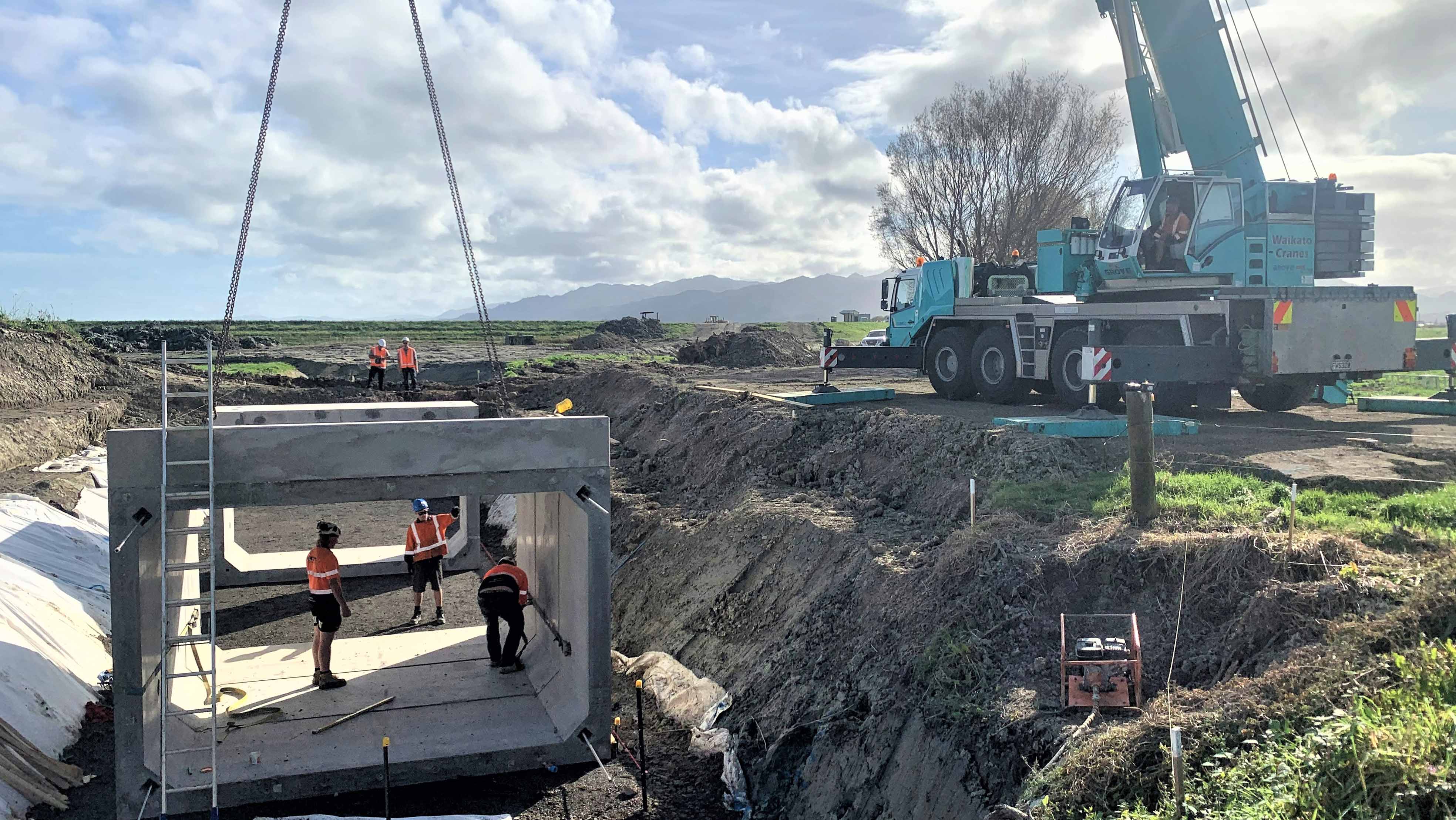
- Stage 1 structures contract for the installation of culvert crossings, including the replacement of the Shelly Beach Road crossing, complete.
- Procurement of stage 2 structures contract underway.
Next steps:
- Complete consent process.
- Complete stage 2 earthworks over 2023/24 summer.
- Construction of floodgate and tidal control structure over 2023/24 summer.
- Connect structures to the river.


To ask for help or report a problem, contact us
Tell us how we can improve the information on this page. (optional)