

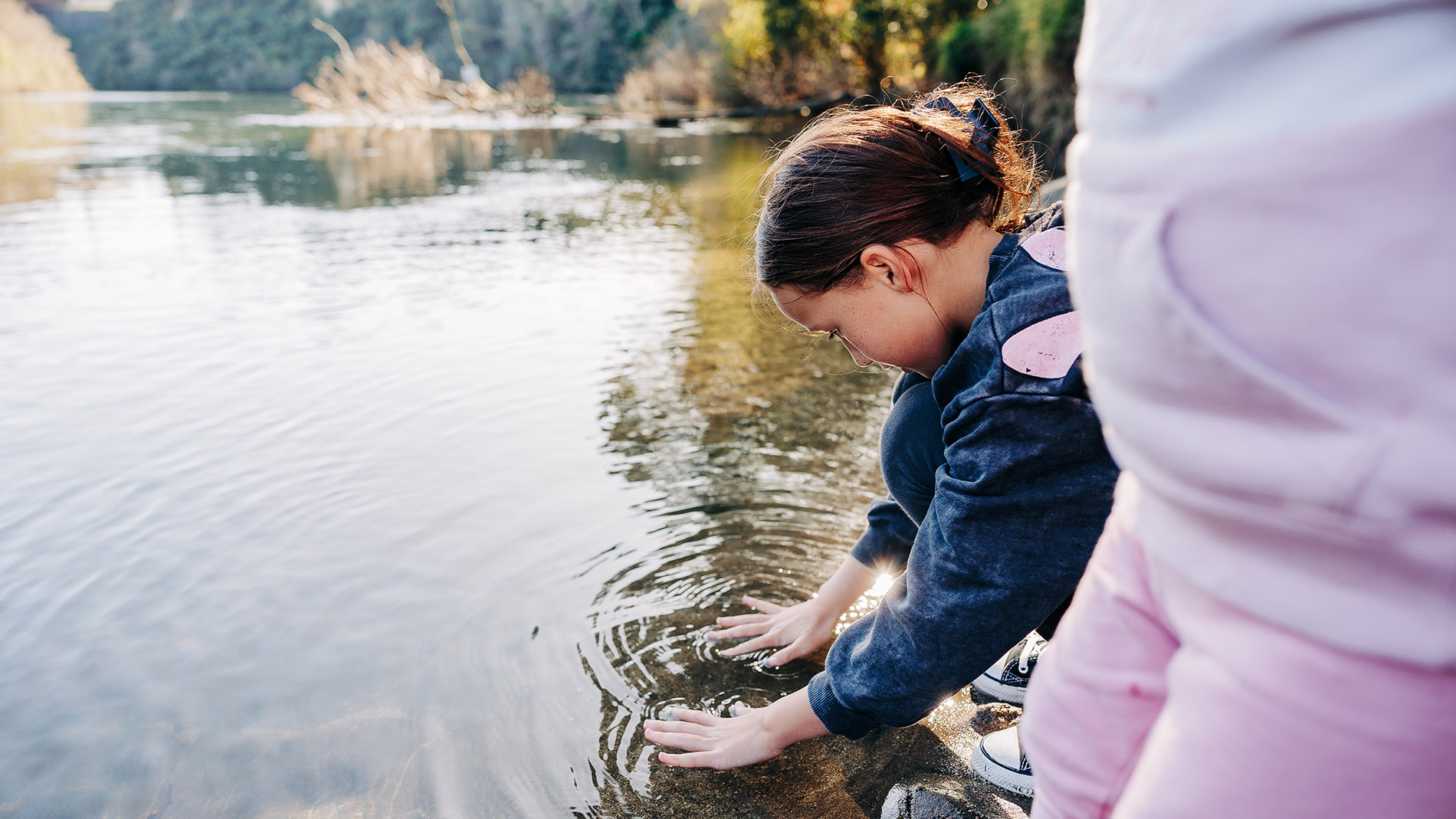
We are looking at how we manage the region’s fresh water activities and we want the people of the Waikato to be involved by telling us what needs and aspirations you have for the rivers, lakes, streams and other fresh waterbodies in your area.
To enable this, central government’s National Policy Statement for Freshwater Management 2020 (NPS-FM) directs regional councils to identify areas called ‘Freshwater Management Units’ (or FMUs). This can be a river catchment, part of a catchment, or a group of catchments.
For the purposes of the Freshwater Policy Review, FMUs have been established at an appropriate scale to enable the council, alongside tangata whenua and communities, to determine freshwater objectives and limits, and the targets to be monitored.

Why are they needed?
An FMU enables the council to effectively manage fresh water activities at an appropriate scale. As shown in the diagram below, this involves setting values, objectives, limits, and undertaking freshwater accounting and monitoring.
Freshwater Management Unit boundaries
The concept of ki uta ki tai (from the mountains to the sea) recognises the movement of water through the landscape and the numerous interactions it may have on its journey. This concept, along with cultural considerations, land use, geological features, science and other relevant information, has been a key influence in how we have formed FMU boundaries.
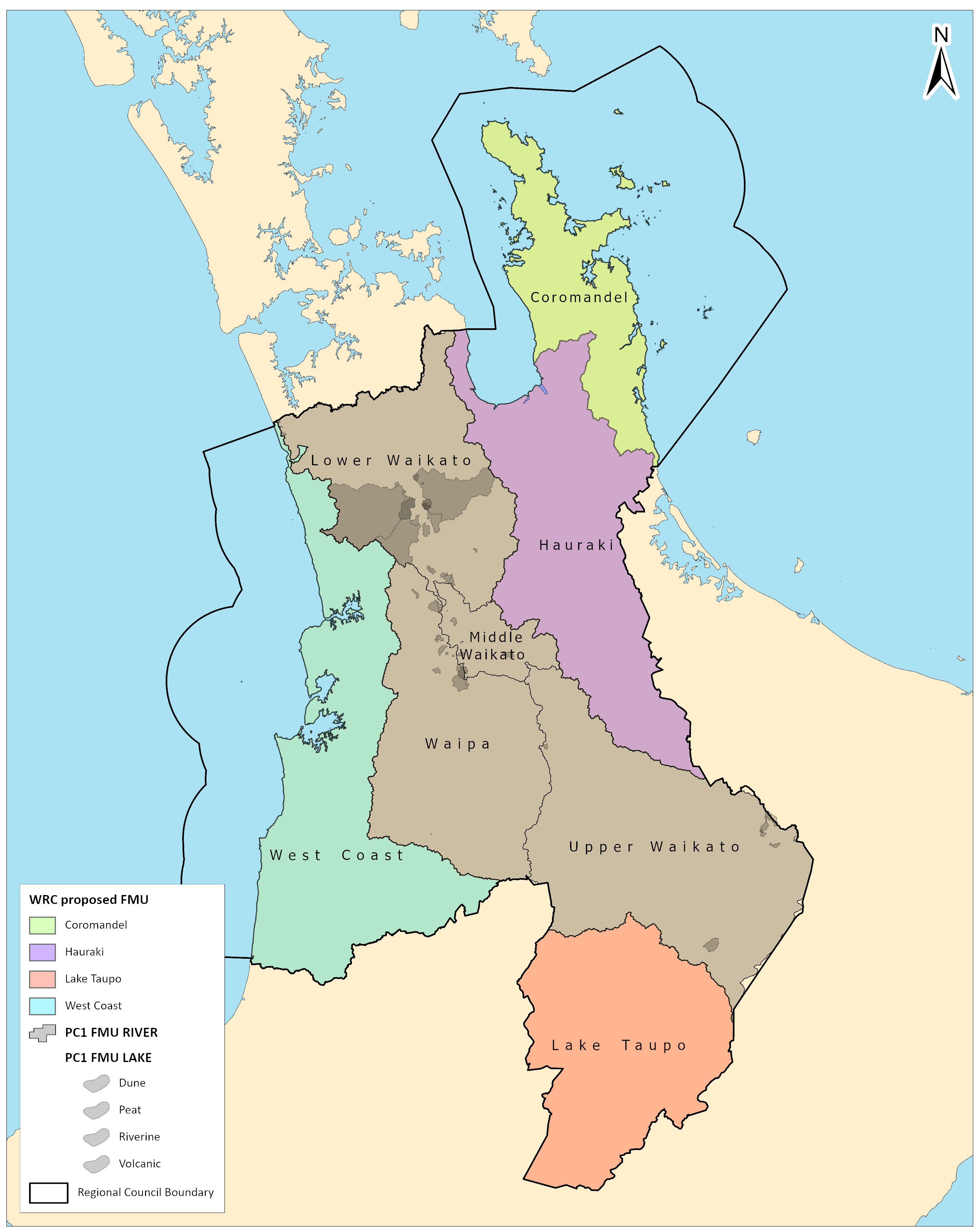
The table below describes each FMU within the Waikato region.
| Freshwater Management Unit | Description |
| Lake Taupō | The entire lake and its catchment upstream of Huka Falls. Includes aquifers, wetlands, lakes and rivers. |
| Upper Waikato | Waikato River from Huka Falls to Lake Karāpiro. Includes lakes, wetlands, aquifers, rivers and streams. |
| Middle Waikato | Waikato River from Lake Karāpiro to Ngāruawāhia. Includes lakes, wetlands, aquifers, rivers and streams. |
| Lower Waikato | Waikato River from Ngāruawāhia to Port Waikato. Includes lakes, wetlands, aquifers, rivers and streams. |
| Waipā | The entire Waipā River catchment to Ngāruawāhia, where the Waipā joins the Waikato River. Includes lakes, wetlands, aquifers, rivers and streams. |
| Riverine lakes | Lake FMUs are only the Waikato and Waipā river catchments. There are 15 riverine lakes and their catchments. Many riverine lakes, such as Waikare, Whangape and Waahi are in the northern part of the catchments. |
| Peat lakes | Lake FMUs are only the Waikato and Waipā river catchments. There are 35 peat lakes and their catchments. Many peat lakes, such as Ngāroto, are in the Waipā catchment. Others include a cluster of eight peat lakes north east of Hamilton in Horsham Downs, and Lake Rotoroa (Hamilton Lake). |
| Dune lakes | Lake FMUs are only the Waikato and Waipā river catchments. There are four dune lakes and their catchments, north of Port Waikato. |
| Volcanic lakes | Lake FMUs are only the Waikato and Waipā river catchments. There are five volcanic lakes and their catchments, in the southeastern part of the catchments. |
| Coromandel | Northern and eastern parts of Coromandel Peninsula. It covers harbours, estuaries and off-shore islands. Includes lakes, wetlands, aquifers, rivers and streams, as well as coastal ecosystems. |
| Hauraki | Catchments draining to Tīkapa Moana/Firth of Thames from the Auckland Council boundary to Tararu. Includes all aquifers, rivers (including estuarine sections, wetlands and lakes) draining into and including Tīkapa Moana/Firth of Thames. |
| West coast | West coast/Tai Hauāuru catchments, including harbours and estuaries (i.e. from the boundary with Taranaki Regional Council to boundary with Auckland Council, excluding entire Waikato River catchment). Includes lakes, wetlands, aquifers/karst systems, rivers and streams, as well as coastal ecosystems. |

To ask for help or report a problem, contact us
Tell us how we can improve the information on this page. (optional)