

Aotea Harbour and Catchment Management Plan
About the Aotea catchments
The catchments of Aotea Harbour cover approximately 16,900 hectares of land along the west coast of the North Island. The Aotea catchment includes 243 kilometres of streams and has been split into six sub-catchments for management purposes: North Harbour, Pakoka, Te Maari, Taparamapua, Okapu, South Harbour.
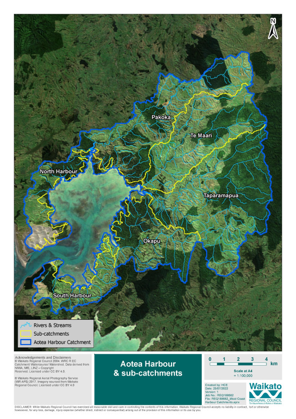
Aotea Harbour covers an area of 3033 hectares, with 52 kilometres of coast, and is the smallest of the three west coast harbours.
The Aotea catchment has changed and developed over time particularly since human settlement. Removal of native vegetation has resulted in increased area of pasture for farming and as other catchment and land use activities increased there has been a change in sediment generation, decline in water quality and indigenous biodiversity and pest animals and plants have increased.
- 16,891ha of land
- 3033ha of harbour and 52km of coast
- 81% harbour exposed at low tide
- 243km of streams
Land use
• 29% indigenous vegetation
• 0.8% wetlands
• 12% mānuka/kānuka
• 36% pasture
• 3% forestry
• 81% steep land
• 60% farming

To ask for help or report a problem, contact us
Tell us how we can improve the information on this page. (optional)