

First high definition 3D maps released of Waikato region
| Published: | 12/05/2023 |
The first set of highly accurate 3D mapping data for the Waikato region has just been released and will be a “gamechanger” for councils and the wider community.
LiDAR (Light Detection and Ranging) technology is being used to create exact 3D maps of the surface of the entire region.
It’s part of the Provincial Growth Fund LiDAR data capture project and will improve Waikato Regional Council’s ability to more accurately model natural hazards and climate change, design better infrastructure, support better land use planning, and improve environmental outcomes for the regional community.
This set of data is Waikato’s first to be published on the Toitū Te Whenua Land Information New Zealand (LINZ) Data Service. Remaining data for the region will be released progressively over the next few months, with the entire region to be available by mid-2023.
Technical lead on the project, Waikato Regional Council’s Bryan Clements, said LiDAR presents a paradigm-shift for regional councils. “Previously we could only access data at sub-catchment scale, other than for small, localised projects. It was either too expensive or impractical to acquire region-wide data at closer scales.
“With LiDAR we can now support the many business needs working at property scale, consistently across the whole region.
“Consider the example of waterways,” Mr Clements said. “Traditionally we have overlaid 1:50,000 topographic rivers and streams data over current aerial photography. When zoomed in, it is obvious that these mapped lines representing waterways are quite inaccurate. But with LiDAR we will use the detailed elevation model to generate highly accurate waterways that are reliable at property scale – the mapped stream will closely align with what you see in the photo.”
He said: “We are excited by the opportunities this provides for regional council core business. But not only will it help us, those benefits will be available to all our regional community through free sharing of whatever we produce. Think coastal care groups, gully restorations, community environmental initiatives, education and research, or farm planners. It is a highly satisfying project to be involved with.”
The data has come about from a joint initiative between Co-Lab and Waikato councils, who secured funding of $1.4 million from the MBIE Kānoa Provincial Growth Fund via LINZ, which is working with regions to generate high-definition 3D maps and models nationwide.
Co-funding partners in the region for the $2.8 million project include Waikato councils, as well as Lincoln Agritech, WEL Networks, Waikato River Authority, Mercury Energy, Toka Tū Ake EQC and Environmental Research Institute at the University of Waikato.
LiDAR covering 50 per cent of New Zealand is now freely available. The national coverage will grow to 80 per cent in 2024 when the Provincial Growth Fund-LiDAR project is completed.
Visit www.data.linz.govt.nz/layer/113203-waikato-lidar-1m-dem-2021 to see the extents of the data set for the Waikato region.
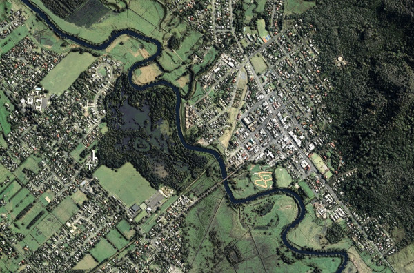
Te Aroha
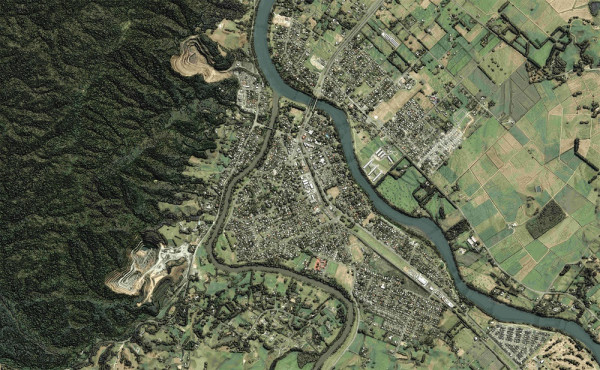
Ngāruawāhia

To ask for help or report a problem, contact us
Tell us how we can improve the information on this page. (optional)