Managing mangroves
About mangroves
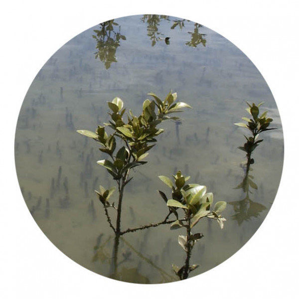
Mangroves in New Zealand comprise of a single native species (Avicennia marina subsp.australasica- also known as Manawa) that has been present in New Zealand for some 19 million years. Mangroves grow along sheltered coastlines in the northern part of the north island. Their distribution is geographically limited by cold temperatures.
New Zealand mangroves:
- provide shelter and food for several species of fish, shellfish, insects and rare birds
- can protect and stabilise land
- form a buffer, in some areas, to absorb floodwaters (for example, protecting shore areas from wave action, erosion and flooding.
Mangroves expansion
The accelerated spread of mangroves in recent decades has been driven by a number of factors including increased sediment discharges to harbours (from vegetation clearance, urban and rural development), reduction in cattle grazing of harbour margins and changing climatic conditions. In addition, areas suitable for mangrove growth may increase if water movements within an estuary are changed. For example, causeways can reduce tidal flushing, promoting sediment build up and hence suitable conditions for mangroves to grow.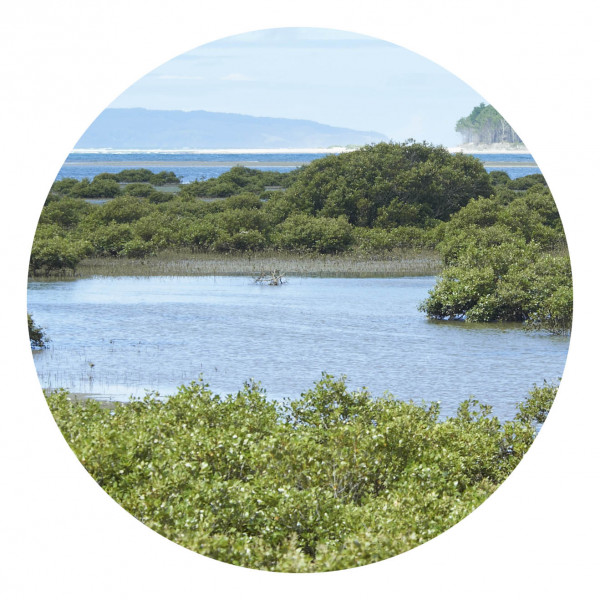
Mangrove removal
Permission is needed
To ensure good overall outcomes for our harbours and the wide variety of plant and animal life they support, it is important that all removal is carried out under the terms of the appropriate resource consents and approved procedures. You could be fined or prosecuted if you remove mangroves without first getting permission from Waikato Regional Council.
Waikato Regional Council has worked with communities to undertake mangrove removal in the Whangamata, Wharekawa and Tairua harbours. This work is only carried out where it is supported by a harbour and catchment plan and is subject to resource consents with stringent conditions on implementation.
Whangamata- In May 2012 the Environment Court approved a resource consent for Waikato Regional Council to remove 22.91 hectares of mature mangroves from Whangamata Harbour, including 4.2 hectares of mangrove stumps still in place from previous clearances.
The consent also authorises the removal of seedlings from the harbour and Moanaanuanu and Otahu estuaries. Under this consent mangrove seedlings (plants less than 20cm in height) can be cut by hand and removed from the coastal marine area between 1 March and 31 August every year.
Before any removal work could begin, management plans had to be prepared and certified by qualified experts. The plans cover air quality (for burning removed mangroves), monitoring, operations, predator control, and restoration activities in the upper harbour. In March and April 2017, we completed a review of those management plans and met with involved parties to the consent to determine the methodology for the last two stages.
Following the last stage of removal in August 2017, a total of 20 hectares has been cleared. This leaves one final stage remaining under the existing resource consent which will happen in either August 2018 or April 2019.
We're continuing to support Whangamata HarbourCare in their seedling removal efforts. Further long-term seedling maintenance will be considered in long term plan discussions and examined in the regional coastal plan review.
Wharekawa – mangrove management in this harbour today involves seedling removal only, in order to hold the line. This work is carried out each year by community volunteers.
Tairua – in mid 2013 Waikato Regional Council was granted a resource consent to remove just under 22 hectares of mature mangroves from the Tairua harbour. This work has commenced and is being progressed in stages according to consent conditions and approved management plans. Eighteen hectares has been cleared with one final stage expected in 2018.
More information
Reports and publications - We have a range of coastal publications. Much of this material is available free for you to read and download online, while other, larger documents or reports can be purchased for a small charge
Coastal hazards, including tsunami
Footnotes
- Pocknall, D.T., Gregory, M.R., and Grieg, D.A. 1989: Palynology of core 80/20 and its implications for understanding Holocene sea level changes in the Firth of Thames, New Zealand. Journal of the Royal Society of New Zealand 19: 171-179.
- Environment Waikato. 2007: Wentworth River Flood Hazard Assessment 2007. Environment Waikato Technical Report 2007/16, Environment Waikato, Hamilton.
- Environment Bay of Plenty, 2007: Estuary Care Review. Report to Council, report no. 010607, May, Catalyst Management Services. http://www.envbop.govt.nz/coast/media/pdf/Mangroves-Report-to-Council-010607.pdf.

To ask for help or report a problem, contact us
Tell us how we can improve the information on this page. (optional)